
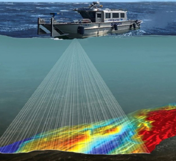
Surveying
No job is too difficult or inaccessible for our survey team. Be it underwater, in the sky, or underground, our survey team uses the most cutting-edge technology and techniques to provide a variety of survey services.
We understand the critical importance of maintaining the integrity and efficiency of your inshore and nearshore water utility assets. Our advanced ROV technology allows us to access and assess your submerged pipelines, outfalls, reservoirs, and other critical assets with unparalleled precision.
From routine structural inspections and leak detection to scour assessments and pipeline integrity checks, our ROV services provide the insights you need to make informed decisions and extend the lifespan of your valuable assets. We help you transition from reactive repairs to a proactive, preventative maintenance strategy, ensuring operational continuity and compliance.
Topside services
- Topographic surveys
- Bathymetric and water course surveys
- Utility mapping
- Setting out and site engineering
- Control network set up
- Monitoring and data collection
- Laser scanning and mapping
- CAD and BIM modelling
- Photogrammetry software and modelling
- UAV (Drone) surveying
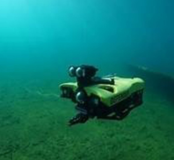
Subsea Surveying - Remote Operated Vehicle
- Minimum Kit, Maximum Impact
- Unrivalled Ease of Mobilisation
- Access to the Inaccessible
- Superior Data Quality
- Environmental Responsibility
- Enhanced Safety
- Reduced Downtime
- Cost Efficiency
- Precision and Accuracy
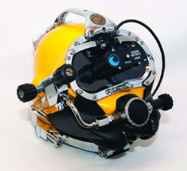
Aris Sonar Explorer 3000
GPS MACS ARIS Defender 3000 system provides unprecedented image clarity even in dark, black or turbid waters.
With 128 distinct physical beams operating at 3 MHz, the ARIS Explorer 3000 can provide higher resolution than any other imaging sonar in its class with unprecedented image clarity even in dark or turbid waters.
We can operate to a depth of 100m and is cabled to the surface for real-time observation of the images within the dive control.
Our diver helmet is fitted with the HUD (heads up display) so the diver is also seeing in sonar imagery, making navigating the task at hand significantly easier, quicker and safer. The maximum cross-range resolution is ~Range (m) * .0044 and the down-range resolution is a maximum ~3mm.
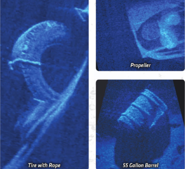
Aris Sonar Explorer 3000 Applications
- Underwater Inspection
- Monitor Operations & Divers
- Construction Monitoring
- Equipment & Tool Placement
- Hull & Berth Inspection
- Environmental Monitoring
- Port & Harbor Security
- Target Identification and Classification
Our in house plant, equipment and resources allows us to self deliver on projects without reliance on supply chains and external parties.
Marine and civil
operations
plant and
vessel hire
Fabrication, Welding &
Engineering Services
Diving
Operations

UXO
Management